
Devil's Bridge: The Quintessential (But Also Stunning) Sedona Tourist Hike
- Stephen Warner
- Nov 17, 2023
- 3 min read
Updated: Apr 3

Google “best hikes in Sedona” and Devil’s Bridge is almost guaranteed to show up. With its natural sandstone arch framed by iconic red rock backdrops, it’s one of the most photogenic spots in the region. Yes, it’s a popular (and often crowded) tourist hike. But with multiple route options and a rewarding payoff, it’s easy to see why this trail is so beloved.
Trail Info-- via Dry Creek Road
(Note: this post covers the hike via the Dry Creek Road route. Alternate route info below.)
Trailhead Name | Dry Creek Road |
Distance | 4 miles / 6.4 km (out and back) |
Estimated time | 2-3 hours |
Elevation gain | 500 ft / 150 m |
Highest point | 4,954 ft / 1,510 m (Devil's Bridge) |
Permits / fees | No |
Parking | Paved lot (Limited space) |
Toilets? | Yes |
Dog friendly? | Yes |
Know before you go
Parking is limited. If you want a spot at the Dry Creek Vista lot, you’ll need to arrive early (especially on weekends), go during an off time, or take the free Sedona Shuttle to the trailhead.
Expect a wait at the bridge for a photo op. I didn’t get a photo of myself on the bridge. It wasn't for a lack of trying but for a lack of patience—there was a line of 50 people. If you want your photo on top, be prepared to queue up.
There are multiple ways to reach the bridge. All routes lead to the final Devil’s Bridge Trail (about 1 mile / 1.6 km), but the approach varies in distance, vibe, and parking convenience.
Alternate Routes
As mentioned, there are three other routes to connect to the Devil's Bridge Trail, all with equal elevation gain of 500 ft / 150 m:
Trailhead Name | Distance | Estimated time |
Dry Creek 4x4 | 2 miles / 3.2 km | 1-2 hours |
Mescal Trail | 4 miles / 6.4 km | 2-3 hours |
Chuckwagon Trail | 5.7 miles 9.2 km | 2-4 hours |
Additional notes on these routes:
Dry Creek 4x4: For those with off-road vehicles, this lets you drive the rough road and start closer to the bridge.
Mescal Trail: Starts from a separate trailhead and avoids the dusty road walk. As of 2022, shuttle access is available here—making it the most balanced option.
Chuckwagon Trail: Same starting area as Dry Creek but bypasses the 4WD road with more scenic trail. Adds mileage, but it’s a peaceful approach.
My take? Mescal is the move. It avoids dusty roads, keeps your mileage manageable, and the new shuttle option is a huge win.
The Trail

If you go via Dry Creek Road, here’s what to expect at the start: wide open road walking with some decent red rock views… but it’s still a road. It doesn’t quite have that “immersed in nature” feel.
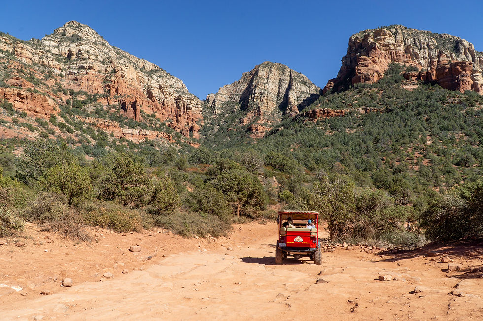
Also, be ready to hop off the road now and then for passing 4WD vehicles. I saw a bunch of open-air tour Jeeps that honestly looked kind of fun. Maybe next time.

After about a mile, you’ll reach the junction with Devil’s Bridge Trail. From here, the road ends and the real trail begins.

This part of the trail is likely to be crowded. The first half is mellow, but it ramps up as you get closer to the bridge.

The most difficult section comes just before the bridge. It's steep and with a bit of scrambling. It’s nothing too technical, but it might catch folks off guard given how tame it's been up to this point. Take your time.

And there it is: Devil’s Bridge. Not pictured? The massive line of people waiting their turn for that classic photo op. I did the math. At one minute per person, I would’ve waited over an hour. I settled for a landscape-only shot. Still, it's hard to deny this spot’s magic. There’s something captivating about this rugged natural bridge perched in such a striking setting.
SS Reflections
I have a saying: “Tourist hikes are touristy for a reason.” They’re usually accessible, rewarding, and unforgettable—even if you’re sharing the experience with dozens (or hundreds) of others.
Devil’s Bridge is exactly that. Yes, it’s crowded. Yes, the road walk isn’t ideal. But the payoff? Absolutely worth it. And sometimes, part of being a hiker means embracing the moment, even if it’s a bit less serene than you’d prefer. Because skipping a place like this just to avoid crowds means missing out on something truly special.
Helpful Resources
Forest Service's official page about this trail
Earth Trekker's detailed write up about the different routes